

Even though many Christmas Bird Counts are cancelled you and your family can still contribute this year.
Suggested Birding Locations for December 2020
Sacramento Audubon Field Trip Activities Chair, Maureen Geiger, and Field Trip Leader, Cathie Lazier, offered the following recommendations for places to visit in December.

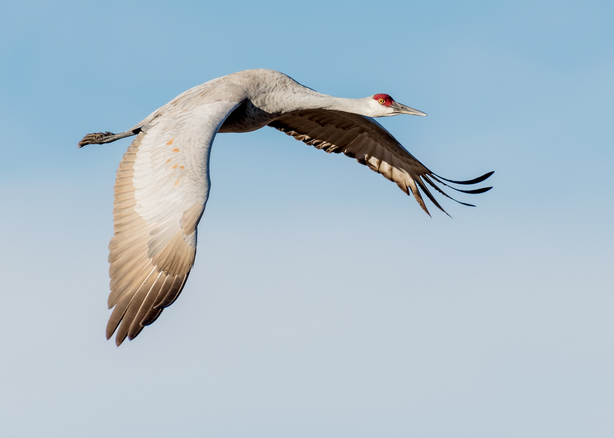
Sandhill Cranes,
Cosumnes River Preserve
Image by Larry Hickey

Yellow-rumped Warbler
Image by Daniel Brown
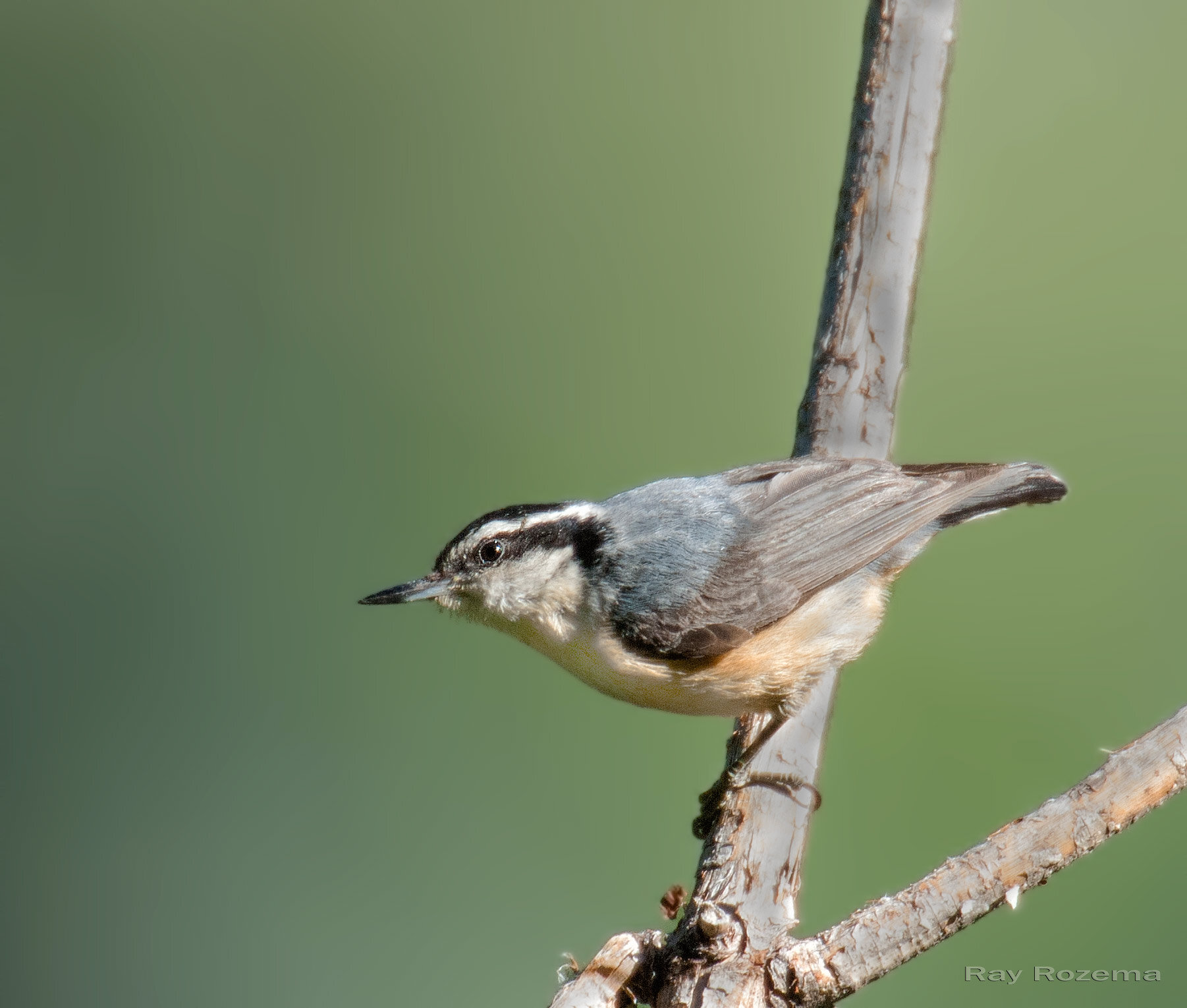
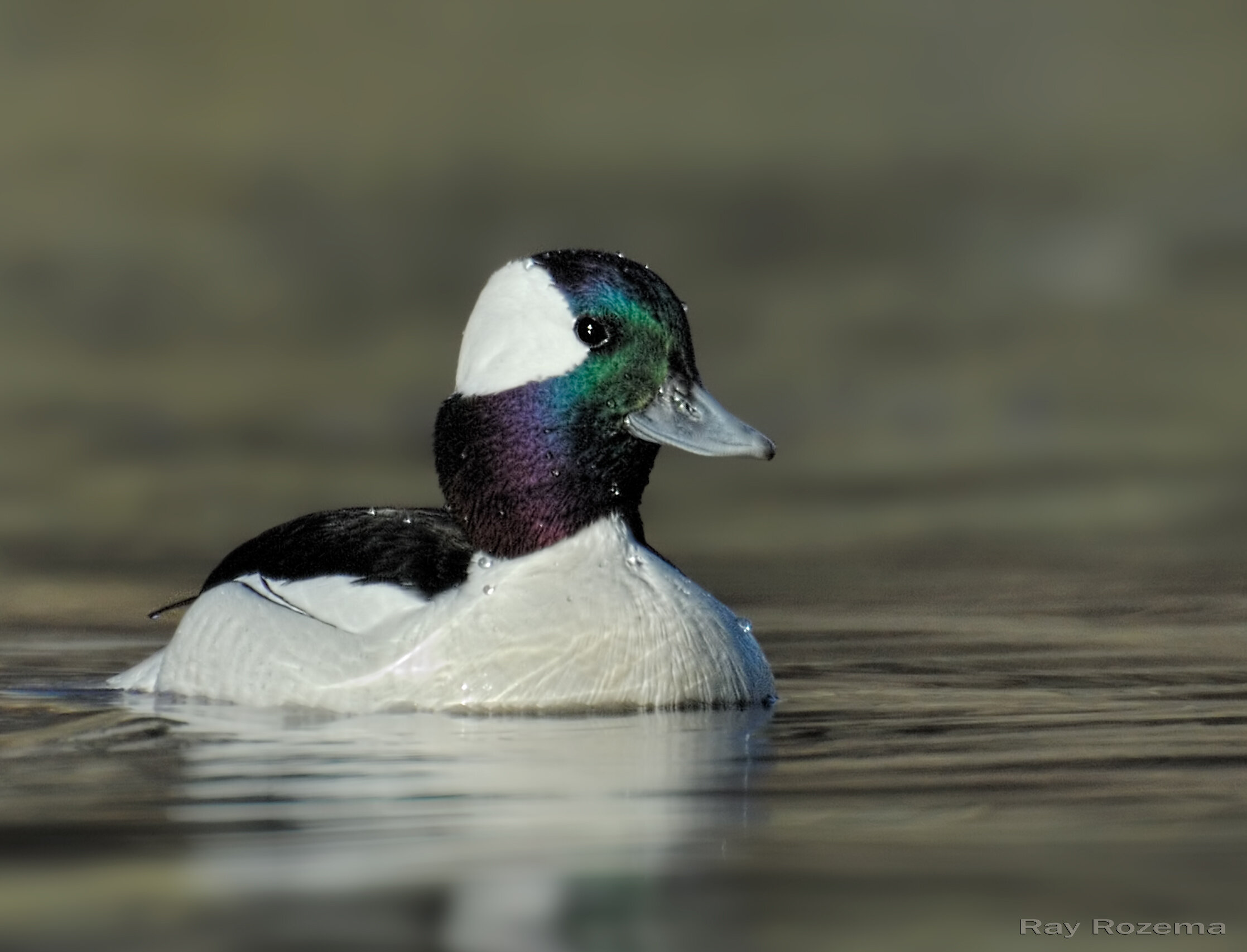
Red-breasted Nuthatch
Image by Ray Rozema
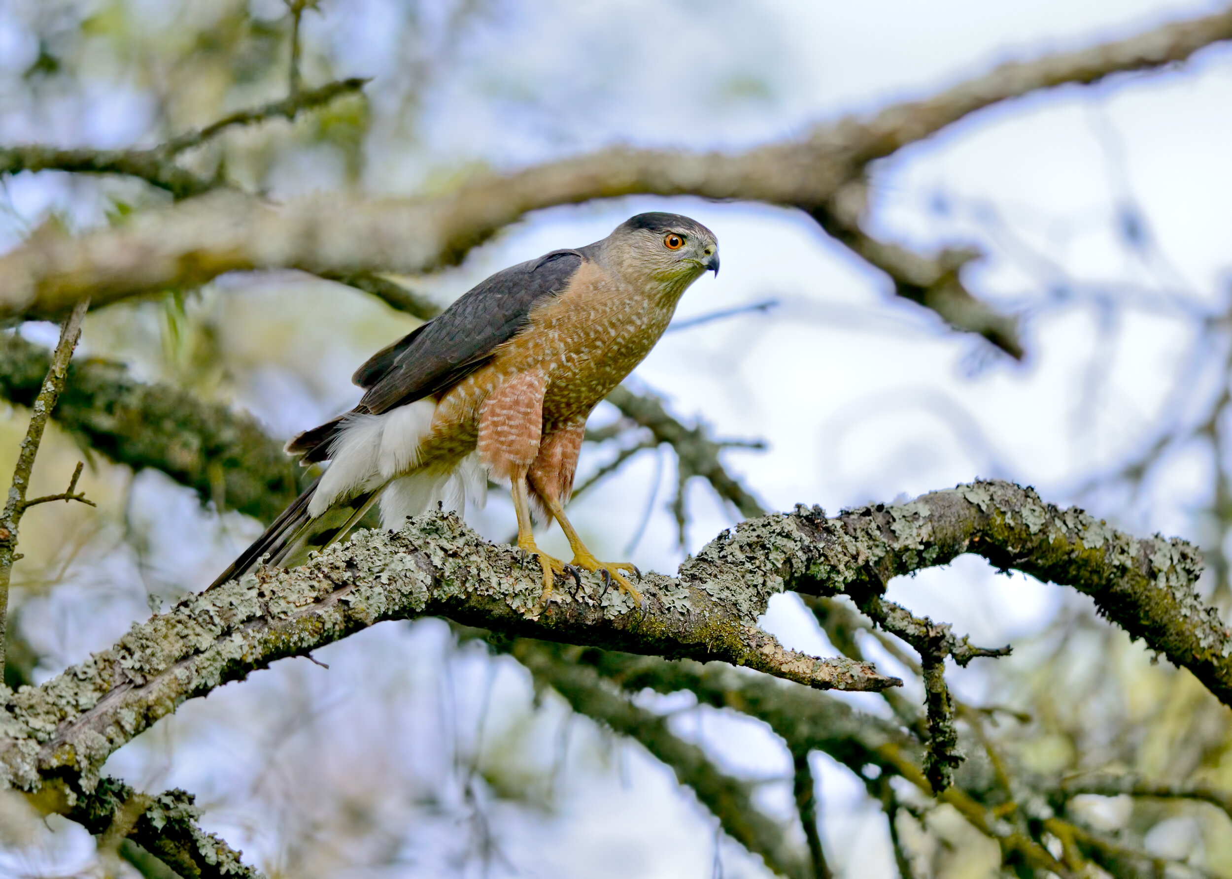
Cooper’s Hawk
Image by Daniel Brown
Sandhill Cranes, South of Sacramento off I-5
Sandhill Cranes are a specialty of the Central Valley in late fall and winter, and unlike birding for other species, late day-early evening viewing of these amazing birds can be a great success. Several of the best places to do this are south of Sacramento near I-5. First in the string of sites is Cosumnes River Preserve where they can be found along Desmond Road and on both sides of Franklin Boulevard.
My favorite Crane experience can be found at Staten Island late afternoon and just past sunset. This is when large numbers of Sandhill Cranes come in to rest overnight in the safety of shallow, flooded fields. To see these birds against the sky at dusk, especially if there is also a great sunset, is a wonderful treat. Birding is done from the road only as this is a working agricultural area.
The third site heading south on I-5 is Woodbridge Ecological Preserve (aka Isenberg Crane Preserve.) Viewing from a parking lot is excellent any time of the day, and one of the places where the fly-in at dusk can be spectacular.
All three venues also support large numbers of ducks and geese. Shorebirds may be present, raptors work the surrounding fields, and wintering sparrows can be found in the open fields and along hedgerows.
- Maureen Geiger
Directions
Cosumnes River Preserve - drive south on I-5 from Sacramento about 20 miles to Twin Cities Road. Exit and cross over the freeway heading east to Franklin Boulevard. Turn right onto Franklin and go south 1.7 miles; the Visitor Center will be on the left.
Staten Island - take I-5 south from Sacramento for 24 miles to the Walnut Grove/Thornton exit, #493. Head west for 3.8 miles on Walnut Grove Road. Shortly after crossing the Mokelumne River, turn left on Staten Island Road. Continue down this road about half a mile to the flooded fields. Stay on the road as this is a working agricultural area.
Woodbridge Preserve - from Sacramento take I-5 south to Peltier Road, exit #490. At the bottom of the exit, turn left to Thornton Road where you will go right. Continue on Thornton until the stop sign at the corner of Woodbridge Road. At this point make a right turn only Woodbridge Road which goes west under the I-5 freeway. Drive 2.4 miles to the turnout of the Preserve on the left side of Woodbridge Road.
River Bend Park
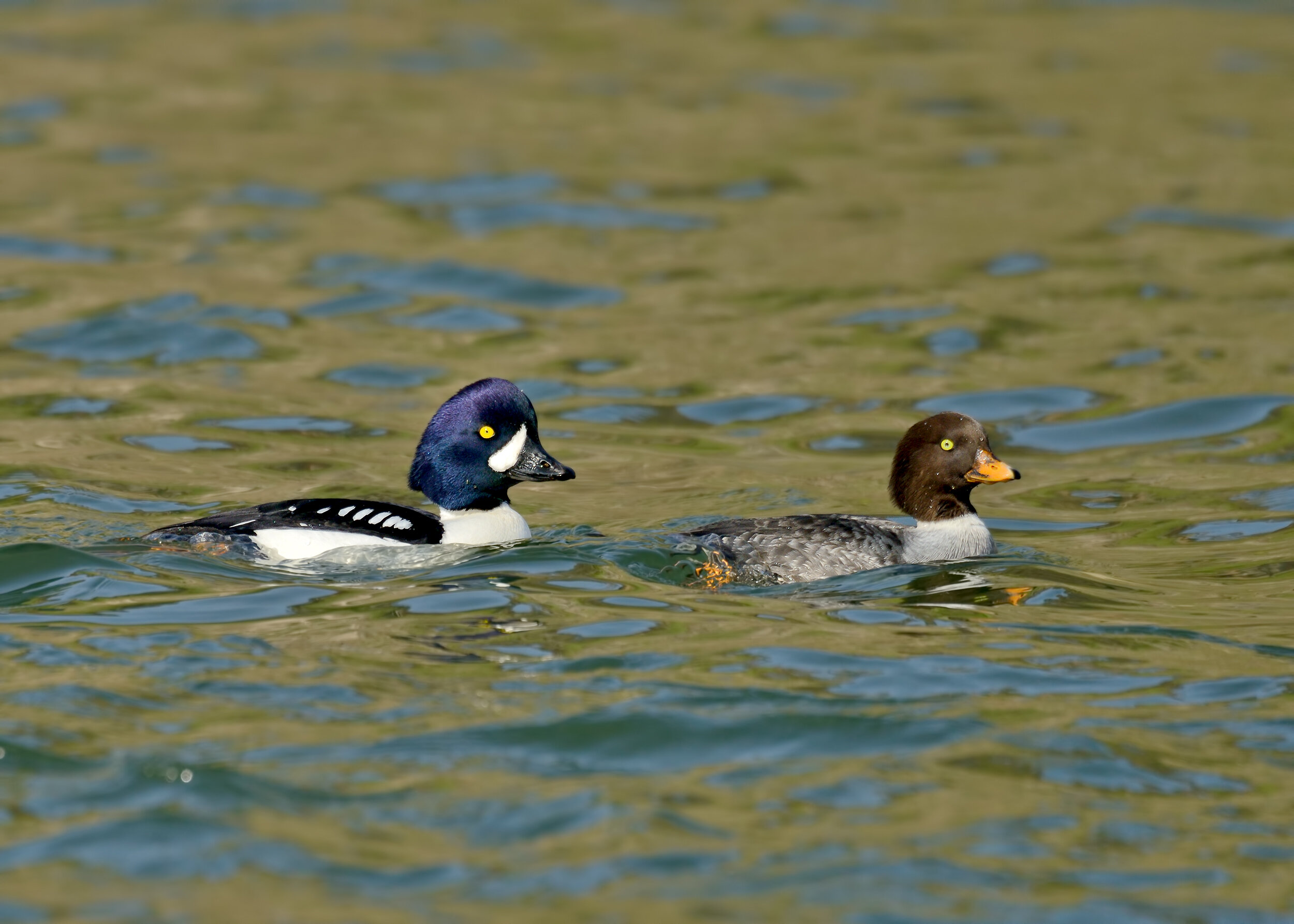
This large, wooded park offers a variety of trails to explore, riverfront, shaded oak woodlands and open grassy areas. Entering the park, follow the road in till it crosses the bike path, then take your first left and continue to the main parking area. The mown picnic area lawn is good for turkeys, Western Bluebirds, Dark-eyed Juncos, Yellow-rumped Warblers, and Red-shouldered Hawks. Then take the river trail going upstream, watching the oak woodland for towhees, wrens, Oak Titmice, and other passerines, and scanning the river for mergansers, goldeneye and Bufflehead. Shortly after you pass another parking lot/bathroom/picnic area, there is a large rocky island midstream, which is good for yellowlegs, Spotted Sandpipers and Killdeer. Herons, egrets, and Belted Kingfishers can be found in this area too. When you reach the triangular 15 mile sign, it's time to turn back. You can return on the same trail, or take the side trails down to the cobbled river bank or into the oak woodland. From the developed section of the park you can cross the river on the footbridge to William Pond Park. The bridge offers good views up and down river; sometimes you can watch mergansers hunting underwater. This park is worth several trips, as the extensive oak woodland between the bike trail and the river is criss-crossed with smaller trails. Great Horned Owls are often found in these woods.
Directions: From Folsom Blvd., between Bradshaw and Mather Field Road, take Rod Beaudry Drive north into the park. A Sac County Park Pass or $5 entry fee is required for all vehicles.
- Cathie Lazier
East Lawn Cemetery
This park-like setting has mowed lawns and tall evergreen and deciduous trees such as palm, oak, maple, pine, and magnolia. Dense shrubbery lines the west boundary with a few thickets scattered throughout the cemetery, and paved roads meander through this 40-acre park. The wonderful old trees are a haven for common wintering birds and may produce less common species such as Red-breasted Nuthatches, Mountain Chickadee, and Red-Breasted Sapsuckers. The entrance is at 43rd Street and Folsom Boulevard in Sacramento. Winter hours are 8 a.m. to dusk. Parking is permitted along the paved roads.
- Excerpt from “Birding in the Sacramento Region,” p. 35-36 as written by Mary Beth Metcalf
Bobelaine Audubon Sanctuary
Bobelaine is home to a wide variety of birds and wildlife throughout the seasons. Winter is a nice time to explore the trails and search for resident and wintering birds such as woodpeckers, Cedar Waxwings, Yellow-rumped Warblers, Ruby-crowned Kinglets, Hermit Thrushes, and Spotted Towhees. A variety of other sparrows, including Fox Sparrows, are settling in for the winter. Woodland raptors such as Red-shouldered Hawk, Cooper’s Hawk, and Sharp-shinned Hawk may be found as well. Trails are accessed via a high, steep levee; but once inside the Preserve, you can walk several miles on mostly level ground.
Directions: From Sacramento take Hwy. 99 north toward Yuba City; about 2 miles north of the Feather River Bridge, turn right on Laurel Avenue. Follow Laurel to the dead end at the Bobelaine parking lot.
A Message from the Sacramento National Wildlife Refuge Complex
Free E-Waste Dropoff at Camp Pollock
Sign the Petition to Preserve the Kassis Property Open Space
Why eBird & Some Tips for Using It
Many of you use eBird. But if you don’t, or don’t get out of it what you might, I challenge you to watch the three-minute video (eBird.org/about) and not be inspired. With the sense that so much is going wrong right now, this is something clearly going right.
Using eBird is easy. If you can record a list of birds, you can use eBird. Unlike so many things on the Internet, there are no ulterior motives. eBird is maintained and continuously updated by the Cornell Lab of Ornithology, with many partners, including the National Audubon Society. The goal is simple yet profound: record and archive bird detections from around the world, as many as possible, to get as accurate as possible a picture of where birds are, how many there are, and at what time of year they occur. The conservation and scientific implications are hard to overestimate.
Below the surface are tools that subtly help you become a better birder. When you visit a new area and go to enter your checklist, you are presented with a seasonally appropriate list of species for the region and time of year. These lists are starting points, and should cover all the expected species, as well as expected numbers, for the season. If you find something less expected, you’ll be prompted to provide some details, and you can even upload photos and sounds to document your sighting. eBird is worldwide and is supported by thousands of regional reviewers to maintain the lists of expected species and review unusual records.
To get started, just visit eBird.org. All you need for an account is an email address and a user name (most people use their own name). You can enter lists by signing in on the website, or on a highly usable smartphone app. I am a bit of a Luddite by nature, but the app has won me over. Using GPS, even where you can’t get a cell connection, it will position you in the right spot and give you a checklist to work with in the field, as well as produce a track of your birding route on a satellite map of the area. The search function for use in the field is excellent, and you don’t have to hunt around in a notebook or on a paper list. If you see a Red-tailed Hawk, just entering “rt” in the search bar will bring up the species name. A quick tap will add one, and if you see another, a second tap will record that bird. After using it a few times, it will become second nature.
There just isn’t space to discuss all of the features, but now is the time to get started. Check eBird.org for many guides and tutorials, including eBird Essentials a free on-line course offered by the Cornell Lab of Ornithology.
eBird is a wonderful resource for permanently archiving your records, comparing what you’ve recorded from year to year, archiving your photos and sound recordings (with helpful articles on how to do this). And I barely have space for the outputs. You can explore species range maps that are based on actual reports, including your own. Get bar charts of local abundance for your county, or the hotspot, state or country you will be visiting. View photos and illustrated checklists of any location you can think of, and sign up for alerts of rare birds or species you “need.”
Last point: check out eBird.org/science and watch a few of the abundance animations, now available for nearly every North American species, showing the timing and abundance of their seasonal movements as they play out over a year’s time. eBird is a labor of love by thousands of people and it keeps getting better. What could be better than that?
- Chris Conard

Suggested Birding Locations for November 2020
We are fortunate to live within a few hours of some of the best winter waterfowl and crane viewing in California and November/ December are great months to get out and enjoy it. Veteran birders Tim Fitzer and Ann Burris offer the following recommendations for places to visit this month. Don’t forget to take warm clothes, something warm to drink, your binoculars and a spotting scope, if you have one.
Cosumnes River Preserve
Walking the boardwalk loop is a great way to check out the wintering waterfowl, including a variety of duck species, Greater White-fronted Geese, and Sandhill Cranes. Dowitchers, Wilson’s Snipe, and yellowlegs should be present. There are always some passerines and raptors. Driving Desmond and Bruceville Roads can also be good viewing areas. Visit Cosumnes River Preserve Website for trail information and location directions.

Northern Pintail, Image by Larry Hickey
Colusa National Wildlife Refuge
Approximately 1 hour north of Sacramento, the Colusa NWR is a great location to view large waterfowl concentrations. There will be plenty of ducks and geese, as well as other wetland species, passerines and raptors. Spend time at the viewing platform where a spotting scope will be useful, and then take an easy walk on a level trail through riparian habitat next to the main viewing pond. Finish your outing to this wonderful NWR by taking the short auto tour. Driving directions and maps can be found here.
Ross’s Goose, Image by Ray Rozema
Gray Lodge State Wildlife Refuge
This refuge is a prime wintering area for migrating ducks and geese with both walking trails and an auto route. There is a $4.25 per person charge at Gray Lodge; so it’s wise to bring the exact amount for the Iron Ranger. At the California Department of Fish and Wildlife website, you’ll find driving directions, maps of the wildlife viewing area, a handy bird checklist and more.
Northern Shoveler, Image by Daniel Brown
Sacramento National Wildlife Refuge
This a great refuge for viewing the enormous flocks of ducks, geese and swans that winter in the valley or stop to feed on their way south. This is also a good place for raptors; and Bald Eagles and Peregrine Falcons are a possibility. There are walking trails and a 3.7 mile driving route with a couple of great viewing platforms as well. Please note there is a $6 day use fee for each vehicle at the refuge, or buy a Duck Stamp and support all our national refuges. Driving directions and map of the area and other information can be found at the Sacrament NWR website.
Bufflehead, Image by Ray Rozema
Woodbridge Ecological Reserve (aka Isenberg Crane Reserve)
This Reserve is considered by many as "The Place to see Cranes”. A popular site to watch flyouts and flyins. Ducks, geese and other winter birds can be viewed here too. A CDFW Lands Pass must be in the possession of each visitor who is 16 years of age or older, however, visitors who are in possession of a valid California hunting or fishing license in their name are exempt from this requirement. Lands Passes may be purchased on-line, by phone at (800) 565-1458, or in-person at locations wherever hunting and fishing licenses are sold. Driving directions and maps of the area and other information can be found here.
Sandhill Crane, Image by Daniel Brown
Yolo Bypass Wildlife Area
This great area is only 10 minutes from downtown Sacramento. The area has walking trails and an auto route. Depending on the extent of flooded fields on the auto tour route, there may be good numbers of shorebirds and waterfowl. This can also be a good viewing area for migrating swans. For directions and map of the area visit the California Department of Fish and Wildlife website.
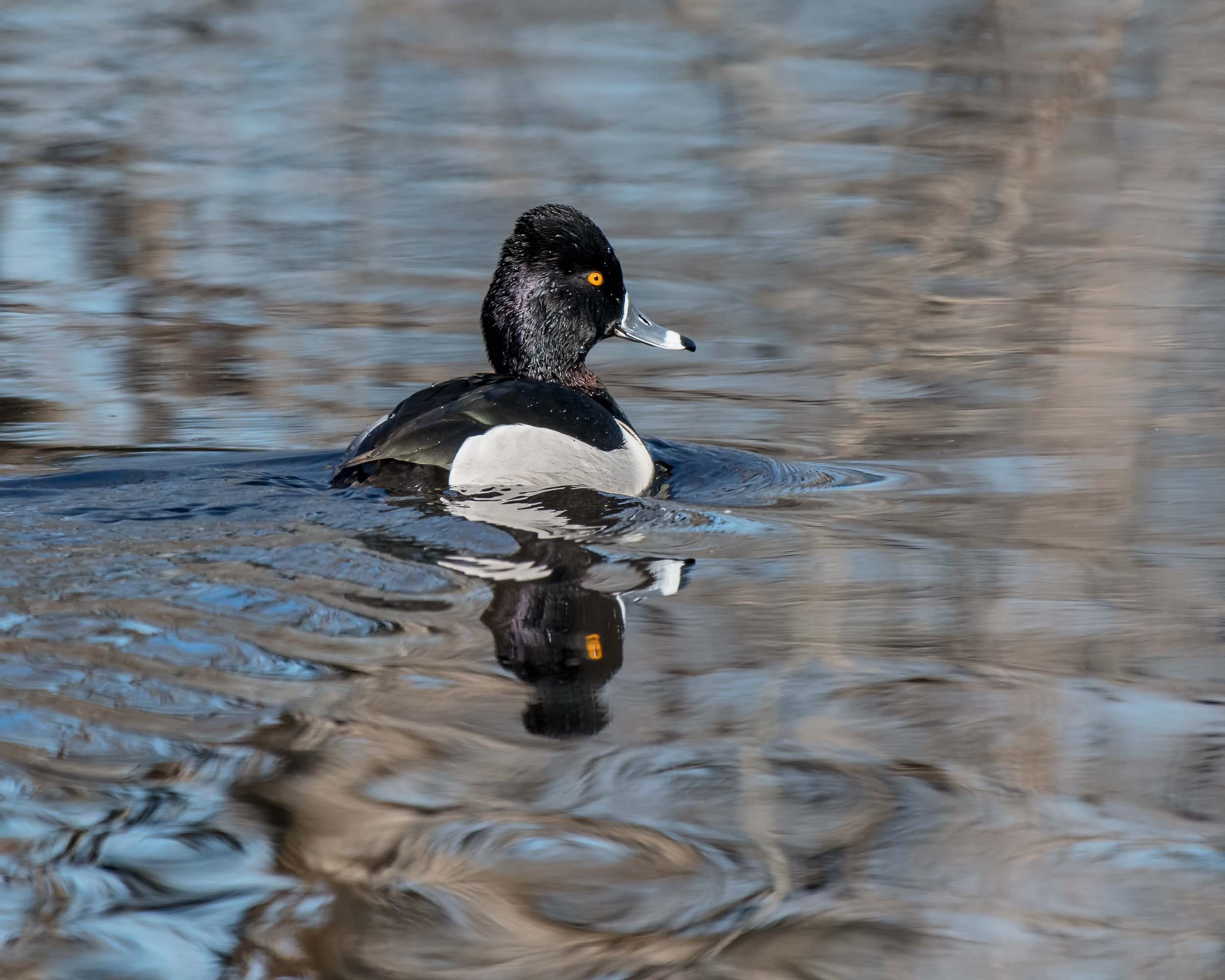
Ring-necked Duck, Image by Daniel Brown
Help Save the Davis WTP Ponds
Proposed Hospital Threatens Birds of Stone Lake Wildlife Refuge
Suggested Birding Locations for October 2020
Veteran birder and Sacramento Audubon Field Trip Leader, Darrell Mohr, offers the following suggestion for great local places to bird this October.
Bushy Lake
This area is an easy walk this time of year. At the parking lot, look along the fence on both sides of the road, as well as the drain area. Goldfinches, House Finches, towhees, and phoebes are usually common in this area, as well as White and Golden-crowned Sparrows. As you walk along the paved road watch for blackbirds out in the field. Look up at the power line towers for hawks. When the paved road splits, take the lower trail at the base of the levee. When you get to the lake watch for Great Blue Herons and Wood Ducks. When the lower trail joins the levee road, turn back on the levee road along the fence and check out the trees for warblers and Great Horned Owls. If you find one owl, look closely; the mate may be nearby.
Directions: Park in the cul-de-sac at the south end of Ethan Way, just south of where Hurley Way goes into Gate 12 of Cal Expo.
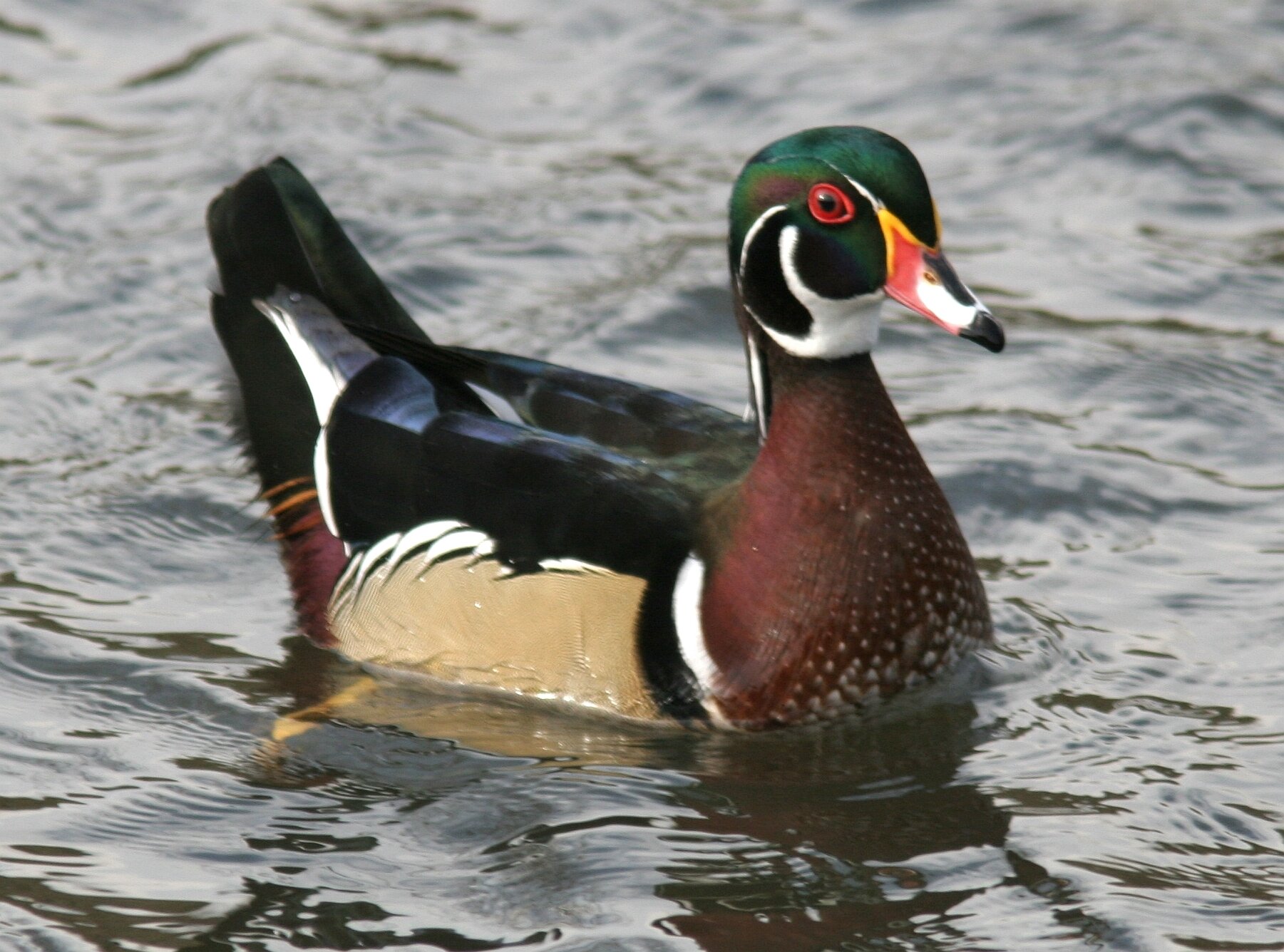
Wood Duck, Image Chris Conard
Sacramento Bar
On the north side of the river, this is a good site to look for a number of species. In the parking lot, watch the trees and brushy areas for Oak Titmice, Bushtits, towhees, and Acorn Woodpeckers. Cross the bike path and head for the American River. Scan the river for Common Mergansers, Bufflehead, and Common and Barrow's Goldeneye. Don't forget to check the shrubbery; often a warbler will be moving through the bushes. Look overhead for swallows as well as White-throated Swifts. If you hear a raspy bird call, look for a Belted Kingfisher. Check the banks of the river for yellowlegs and Spotted Sandpipers, and enjoy your morning!
Directions: From Highway 50, drive north on Sunrise Blvd.; turn left on Fair Oaks Blvd. and take the first left on Pennsylvania and follow it into the park. A Sac County Park Pass or $5 entry fee is required for all vehicles.

Belted Kingfisher, Image by Ray Rozema
Mather Lake
Mather Regional Park is a gem for finding different species. There's plenty of parking; survey the area when you get out of your car as the parking lot usually has a number of different species. Look for blackbirds, Great-tailed Grackles, Red-tailed Hawks, and finches. Along the west side of the lake, look for Nuttall's Woodpeckers and Yellow-rumped Warblers. Search the tules for Green Heron and Gallinules. Now go back and across the dam; check the overflow for phoebes and wrens. Along the south side of the lake look for Double-crested Cormorants in the trees. Farther down, look for Yellow-headed Blackbirds. Introduced Mute Swans should be swimming in the lake, along with Pied-billed Grebes and American Coots. Watch the field for California Quail.
Directions: From Highway 50 go south on Zinfandel, Exit #17, about 2-1/2 miles. After crossing Douglas Blvd. take the first left into the park area. Use your Park Pass or pay the $5 fee. Enjoy the morning!

Green Heron, Image by Mary Forrestal
Gristmill Recreation Area
This area can be very productive. Drive all the way in to the last parking lot and walk upstream, keeping an eye out for warblers; a number of rarieties have been found at this location. As you go upstream look for Northern Rough-winged Swallows. The trail will end at a fence. Look in the trees for Varied Thrush. The trail ends at a fence; go back along the river and look for Common and Barrow's Goldeneye and Common Mergansers. Scan the bushes for warblers. Farther down look for Red-breasted Sapsucker. On the return walk, take the upper trail where you may find Downy and Nuttall's Woodpeckers and Yellow-billed Magpies.
Directions: From Hwy. 50 exit at Bradshaw Rd. and go north to Folsom Blvd. Go left on Folsom, then right on Butterfield Way, right on Linda Rio Drive and right again on Mira Del Rio Drive, turning left into the signed access for Gristmill Recreation Area. A Sac County Park Pass or $5 entry fee is required for all vehicles.
Barrow’s Goldeneye, Image by Daniel Brown