The striking canyons of the North and Middle Forks of the American River provide a backdrop to several good birding and hiking areas just outside of Auburn. Most of these sites would have been destroyed by the proposed Auburn Dam. The area is very nice in winter and spring.
Please note that Lyme Disease has been found in relatively high concentrations in the Auburn State Recreation Area. Ticks are an unpleasant reality of outdoor activities, but a special effort should be made to find and remove any ticks picked up here. Avoid brushing against vegetation as much as possible. The tiny western black-legged ticks (“deer ticks”) transmit the disease. They are encountered more often in the foothills than on the Valley floor, where the larger dog ticks are more common. Also please note that mountain lions occur here.
Birding the site: Several hiking trails radiate out from the confluence of the two forks near the Highway 49 bridge (Foresthill Bridge) over the American River. For a pleasant walk along the river just below the confluence, park on the right side of the road just after crossing the river on Highway 49. Walk along the Western States Trail downstream as it crosses the river on the “No Hands Bridge”. Typical oak woodland species are to be found. Watch for Common Mergansers with their broods in spring. There is a nice waterfall on the right side of the trail about a mile from the highway.
The Quarry Road trail along the Middle Fork of the American River provides a nice mix of oak woodland and riverine habitat. Reach the trailhead by taking a dirt road to a large parking area on the left side of the highway in 0.2 mile after crossing the river on Highway 49. eBird Sightings
You can also drive south on Highway 49 to the town of Cool. Turn right at the fire station as you are entering town, then left just past the station into the parking area. This is the trailhead for the 9-mile Olmstead Loop Trail, but many other trails crisscross the area. This location is largely characterized by rolling oak savanna, but it also contains oak and pine-oak woodland, and has several ponds with associated wetlands.
Additional trailheads can be reached by taking Old Foresthill Road straight ahead instead of following Highway 49 to the right across the river. There are a few parking spaces immediately on your right overlooking the confluence. A steep hiking trail runs directly up the hill along a small creek. This area is very lush, with some Douglas firs.
To reach the Stagecoach trailhead, continue on Old Foresthill Road for 0.3 mile beyond Highway 49 and park in the dirt lot on the left. The trail climbs steadily but reasonably through mixed oak woodland for two miles before reaching the outskirts of Auburn. By mid-morning, there are often many Turkey Vultures aloft, along with a few Red-tailed Hawks. eBird Sightings
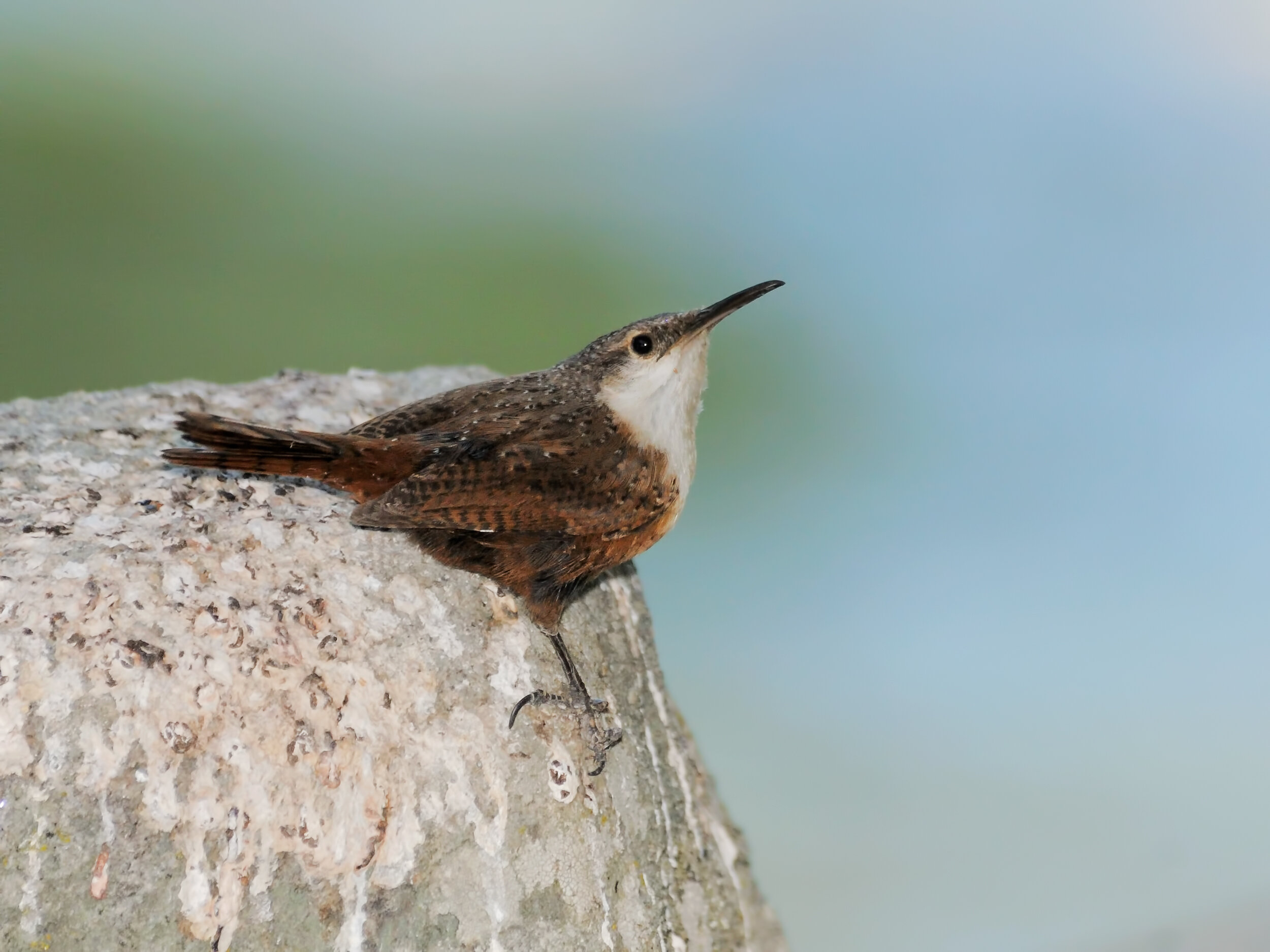
Canyon Wren, Image by Daniel Brown
Just across the river from the previous site on Old Foresthill Road is the trail to Lake Clementine. It runs for about two miles, going under the Foresthill Bridge, along the North Fork to an impressive waterfall created by water falling over the North Fork Dam. Canyon Wrens have been found near the dam, and Yellow-breasted Chats have been reported along this trail in the tangles near the river. Across from the trailhead to Lake Clementine, there are Native American bedrock mortars in the rocks, at the apex where the two forks of the river come together. American Dippers have been reported just below the confluence.
You can also reach Lake Clementine by car from Foresthill Road. Along the way, there is a good location for Bell’s Sparrows just after you cross the Foresthill Bridge (1.3 miles from Interstate 80). Park at a pull-out on the left side of the road by a green gate and walk up the hill into the good chaparral habitat. Other chaparral species, such as California Thrashers, may be found here. eBird Sightings (If this trail is overgrown, check your legs for ticks). If you park near the bridge, you can walk onto it for excellent views of the North Fork of the American River below. The road to Lake Clementine is 3.3 miles from Interstate 80. Turn left, and it is 2.5 miles to the lake.
Another good site is Driver's Flat. Turn right off Foresthill Road 7.8 miles from Interstate 80. This is an excellent site for Yellow-breasted Chats (spring), as well as Band-tailed Pigeons (winter/spring). Calliope Hummingbirds, Steller's Jays, and Chipping Sparrows are among the expected foothills species. eBird Sightings Park in a gravel lot 0.4 mile from Foresthill Road and check the area for woodland birds. Then, continue down the road about 0.5 mile and stop and listen for the hoots, whistles and chattering of Yellow-breasted Chats. To actually see a chat, continue down the road to the Middle Fork of the American River and check the willows just past the campground.
Directions: From Sacramento, take Interstate 80 east (32 miles from Interstate 5) to Auburn. Take the Highway 49 exit (exit 121) and turn right, toward Placerville. Continue on Highway 49 for 3.5 miles to the confluence area where the highway crosses the river.
To reach the Foresthill Bridge area, continue east on Interstate 80 another two miles beyond Highway 49, exit at Foresthill Road and turn right. Cross the Foresthill Bridge in 1.3 miles
Chris Conard and Scott Hoppe

