As the summer in the Central Valley is a little warm and spring migration is past, it is time to head east for better birding. Or if you don’t want to travel, try some of our local nature areas in early morning when it’s cool!
Loney Meadows

Williamson’s Sapsucker, Image by Daniel Lee Brown
Loney Meadows is a beautiful mountain meadow north of Grouse Ridge near Bowman Lake at about 6000’ elevation. The area can have some excellent birding. Reports include 8 species of woodpecker (including Pileated, Black-backed and Williamson’s Sapsucker), also Townsend’s Solitaire, Calliope Hummingbird, Willow Flycatcher, 7 species of warbler and some trips have produced Bald Eagles. This area requires a hike of about 2-3 miles over mostly level terrain, however, there is one short, fairly steep incline, and a creek crossing on stepping stones.
Directions
From the U.S. Forest Service: From Interstate 80 west, take Highway 20 approximately 4.5 miles to Bowman Lake Road (USFS Road 18). Turn right and travel approximately 10.5 miles until just after the pavement ends. Turn right where a sign marks the rough, cattle road 0.7 miles away. You will travel through a logged area and veer to the left to the Loney Meadow Parking lot.
Google Map
More information on Loney Meadows can be found at the U.S. Forest Service website.
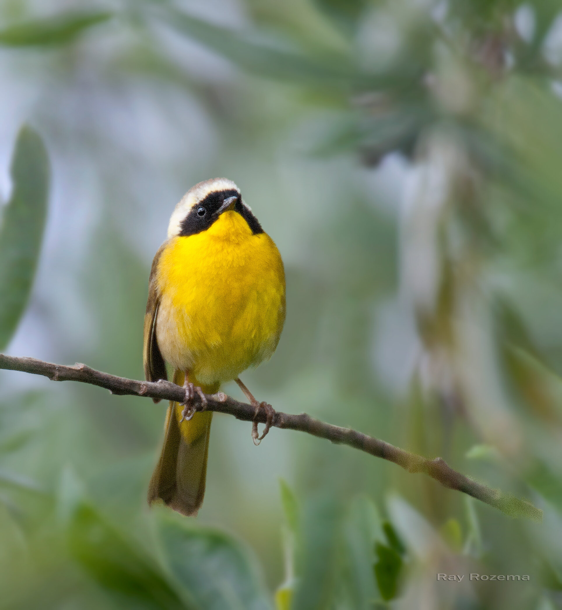
Common Yellowthroat, Image by Ray Rozema
Mather Lake is a great local birding location, and usually turns up quite a list of bird species. You can expect a nice variety of resident and migrant birds. Possibilities include White-tailed Kites, California Quail, American Bittern, Green Heron and Common Yellowthroat.
Directions
Address: 4111 Old Eagle's Nest Road, Mather, CA 95655
From Highway 50: go south on Zinfandel, Exit #17, about 2-1/2 miles. After crossing Douglas Blvd. take the first left into the park area.
Parking & Fees: A Sac County Park Pass or $7 entry fee is required for all vehicles.
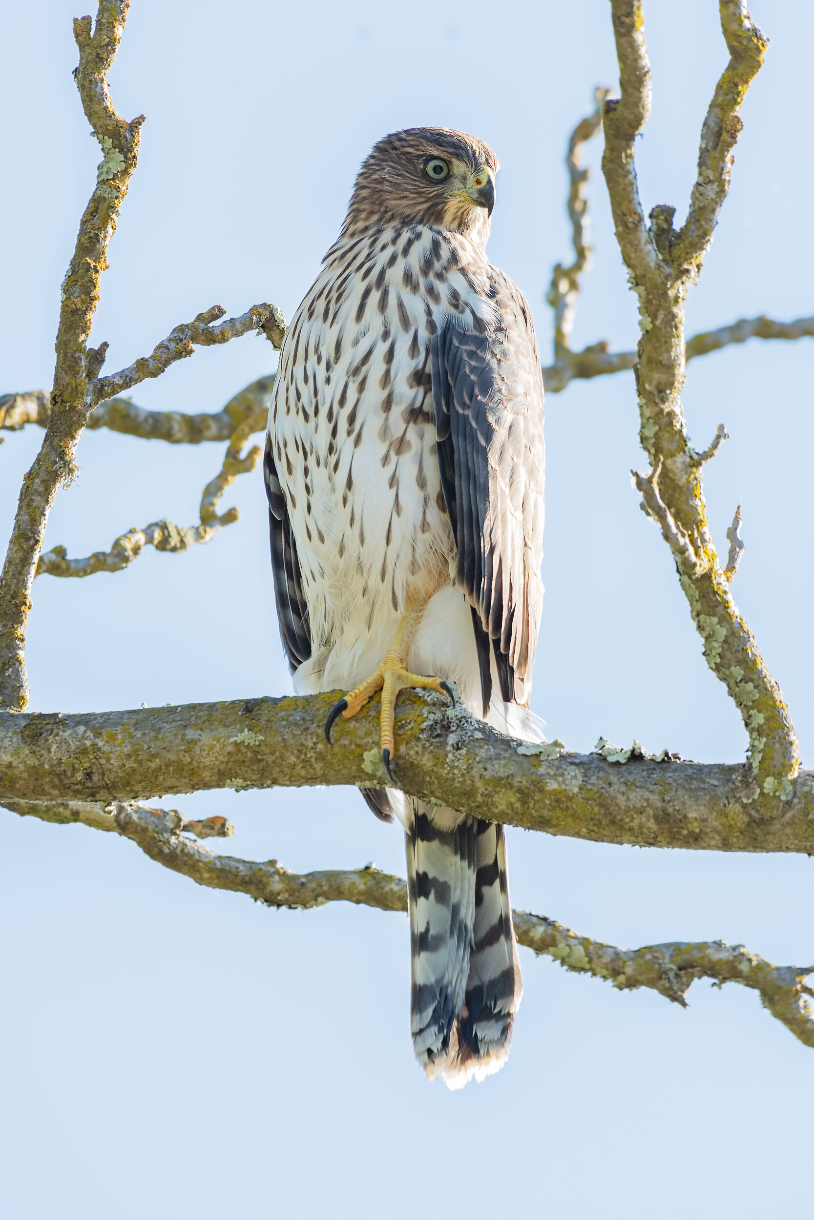
Cooper’s Hawk, Image by Daniel Lee Brown
River Bend Park is nice for a morning walk through the oak woodland to the American River, looking for our summer birds on nests or in cavities, singing and feeding young. Some wildflowers should still be blooming. This is a good spot for beginning birders. Morning is best.
Directions
Address: 2300 Rod Beaudry Dr, Sacramento, CA 95827
From Folsom Blvd, between Bradshaw and Mather Field Road, take Rod Beaudry Drive north into the park.
Parking & Fees: A Sac County Park Pass or $7 entry fee is required for all vehicles.
Indian Grinding Rocks State Park, Amador County
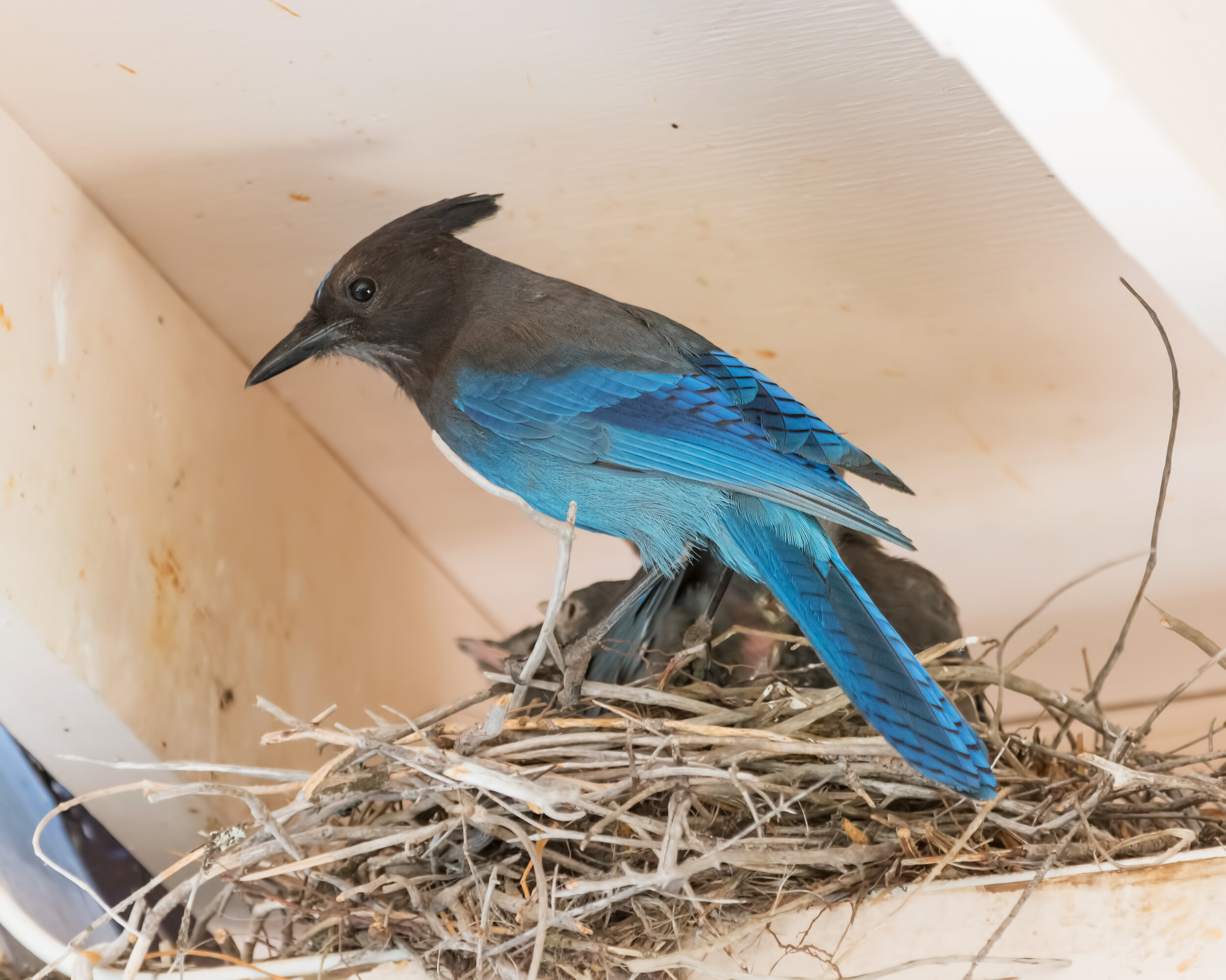
Stellar Jay, Image by Daniel Lee Brown
The birdlife in this area varies depending on the season, but many species are seen year round, including Turkey Vultures, Scrub and Steller’s Jays, California Quail, Acorn and Hairy Woodpeckers, Northern Flickers, Hermit Thrushes, Wild Turkeys (non-native), and California Thrashers. In summer, the bright colors of the Western Tanager, Bullock’s Oriole, Calliope and Anna’s Hummingbirds can be seen in the woods around the meadow. Some light to moderate walking is required.
Directions
The park is northeast of Stockton in the lower foothills of the Sierra Nevada mountains.
Address: 14881 Pine Grove Volcano Rd, Pine Grove, CA 95665
Take State Highway 88 East through Jackson to the town of Pine Grove. Take a left turn on Pine Grove-Volcano Road and approximately 1.5 miles later you will arrive at the park. The SECOND turnoff is the main entrance to the day use area while the first turn off is to the campground.
Parking & Fees: $8.00 Day Use Fee or you may use a California State Park Pass.
More information on Indian Grinding Rocks Historic State Park.
Crystal Basin

Black-backed Woodpecker, Image by Daniel Lee Brown
Crystal Basin is a great place for birding in late spring. Flycatchers, MacGillivray’s Warblers, several species of woodpeckers, Mountain Bluebirds and Calliope Hummingbird are all good possibilities. If you are lucky, you can find Mountain Quail with young. Expect to spend a full day birding. Be sure to bring warm clothes as the weather can much chillier in this area.
Directions
From Sacramento, take Highway 50 east to Ice House Road, about 60 miles. Take Ice House Road and explore any areas along the road that have safe parking.
Google Map
For more ideas on birding along Ice House Road, check out the Riverton-Crystal Basin trip in our Birding Locations pages.
Carson Pass and Lake Winnemucca

Gray-crowned Rosy Finch, Image by Daniel Lee Brown
This is a great trip for mid-summer, after the snow has receded (timing varies depending on the previous winter snow levels). This is a high elevation 3-mile hike (8600 feet elevation) in search of Clark’s Nutcracker, Rufous Hummingbird, Green-tailed Towhee, Chipping Sparrow, Dusky Flycatcher, Pine Grosbeak, Cassin’s Finch and, with luck, Sooty Grouse, Black-backed Woodpecker and Gray-crowned Rosy Finch. At peak wildflower time there are fields of flowers in dazzling variety. Be sure to bring plenty of liquids, wear sturdy shoes and be prepared for changeable Sierra weather. This hike should be considered moderate to strenuous depending upon your physical condition.
Directions
Carson Pass is about 90 miles east of Sacramento via Highway 16 and Highway 88. Parking & Fees: Carson Pass is a USFS fee area for day-use parking.
For more information on Carson Pass check out the following websites:
Yuba Pass and Sierra Valley

White-headed Woodpecker, Image by Daniel Lee Brown
Yuba Pass and Sierra Valley are very good in June and early July with nesting and feeding activity and possibly some newly fledged young. At the pass look for Calliope Hummingbird, White-headed Woodpecker, Western Tanager and other montane species. In the valley, look for Sage Thrasher, Brewer’s and Vesper Sparrows and water birds in the marsh such as Wilson’s Snipe, Willets, Bitterns and Sandhill Cranes.
Directions
From Sacramento, it’s approximately 2.5 hours to Yuba Pass. Head east on I-80; take exit 188B at Truckee and turn left (north) on 89; drive 25 miles to the intersection of highways 89 and 49 in Sierraville. Turn left on Hwy 49 and go about 11 miles to Yuba Pass. Follow signage for Yuba Pass campground. After birding the pass area, head back east on Highway 49 to Highway 89, turn north, then after several miles, turn east on Calpine Road, then North on Westside Road, which changes names to Beckwith/Calpine Road. Follow this road North to Marble Hot Springs Road and turn east. This will take you to the marsh area.
For more information on this birding location, check out this birding guide from the Lahontan Audubon Society.
Want to head to the coast, instead? The following links have great information on birding Point Reyes and Bodega Bay.
Recommendations provided by Sacramento Audubon Field Trip Leader, Dan Brown.