Originally published in May 2022
Sacramento Audubon is again offering field trips. Visit our Field Trips page for more information on available field trips. If you prefer to head out on your own, our field trip leaders have some great suggestions for where to bird each season. For even more great ideas of where to go birding locally, check out our Birding Locations guide. And whenever you go out birding, be sure to keep the ethics of birding in mind.
Suggested Birding Locations for May
May is a great month for birding, with breeding birds singing and displaying and migrants such as flycatchers and warblers arriving or passing through. Any spot along the American River Parkway should be good, but here are a few specific suggestions.

Pacific-slope Flycatcher, Image by Daniel Lee Brown
Putah Creek Riparian Reserve
West of the main U.C. Davis campus Putah Creek Riparian Reserve provides access to a wonderful riparian habitat. Follow the trail along the creek looking for migrating warblers and flycatchers. Head back along the gravel road checking the fields for Western Flycatchers and Swainson’s Hawk. Swallows, Orioles, and Yellow-billed Magpie are just a few of the nesters found at this location.
Directions: Take Highway 113 north from Interstate 80 (about 14.5 miles west of Sacramento). Exit on Hutchinson Drive after 1.2 miles. Turn left, and go 1.3 miles on Hutchinson Drive before turning left on Hopkins Road. At the end of Hopkins Road in one mile, head left and park at the picnic grounds. Walk under the bridge and continue downstream where many migrants and rarities have been found.
-Excerpted from Davis City Limits by Chris Conard
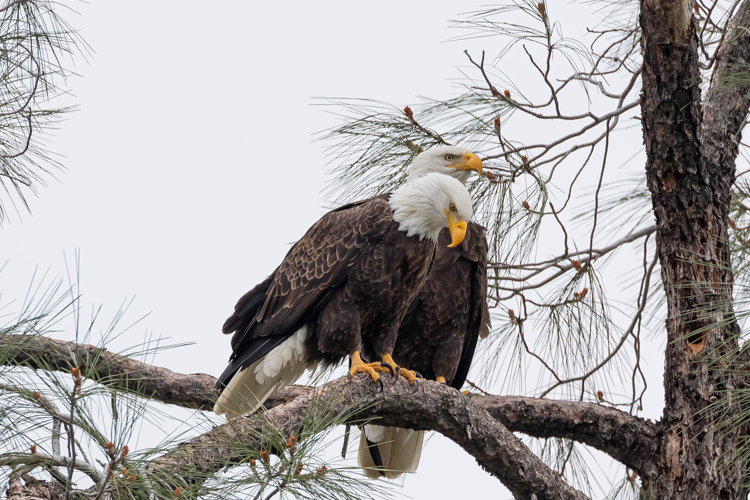
Bald Eagle, Image by Larry Hickey
Falcon Crest, Folsom Lake Area
Adjacent to Folsom Lake, Falcon Crest sits on a peninsula on the south side of Folsom Lake and consists of pine and oak woodlands, grasslands and extensive lake floodplains. The trails are mostly single lane, easy to moderate with a few inclines.
On your walk look for migrating warbles. Yellow, Hooded, Townsend’s and Wilson’s Warblers are all possibilities. Keep an eye and ear out for newly arrived summer residents, such as Lazuli Bunting, Black-headed Grosbeak, Bullock’s and Hooded Oriole, Western Wood-Pewee, Ash-throated Flycatcher, and Western Kingbird. A resident pair of nesting Bald Eagles are often spotted from the trail. Wildflowers are also abundant this spring: globe lily, blue-eyed grass, blue dick, golden brodiaea, shooting star, johnny tuck, several species of lupines, Douglas iris, and buttercup.
Directions: From Sacramento take highway 50 eastbound towards Placerville. Take exit #30B (El Dorado Hills Blvd). Go under the overpass and continue northbound on El Dorado Hills Blvd for 4.2 miles to Green Valley Road (El Dorado Hills Blvd becomes Salmon Falls Road). Continue on Salmon Falls Road for 3 miles to a large gravel parking lot on the left, with a large wooden sign reading “Falcon Crest.” Use caution when crossing oncoming traffic. Parking is free at this time (May 2021) in the gravel parking lot, but there is also a ($10 fee) paved parking area with a porta-potty down the single lane road to the right of the gravel parking lot.
For more information on specific trails, visit MyFolsom.com.
- Excerpted from Falcon Crest, Folsom Lake Area written by Craig DeMartini.
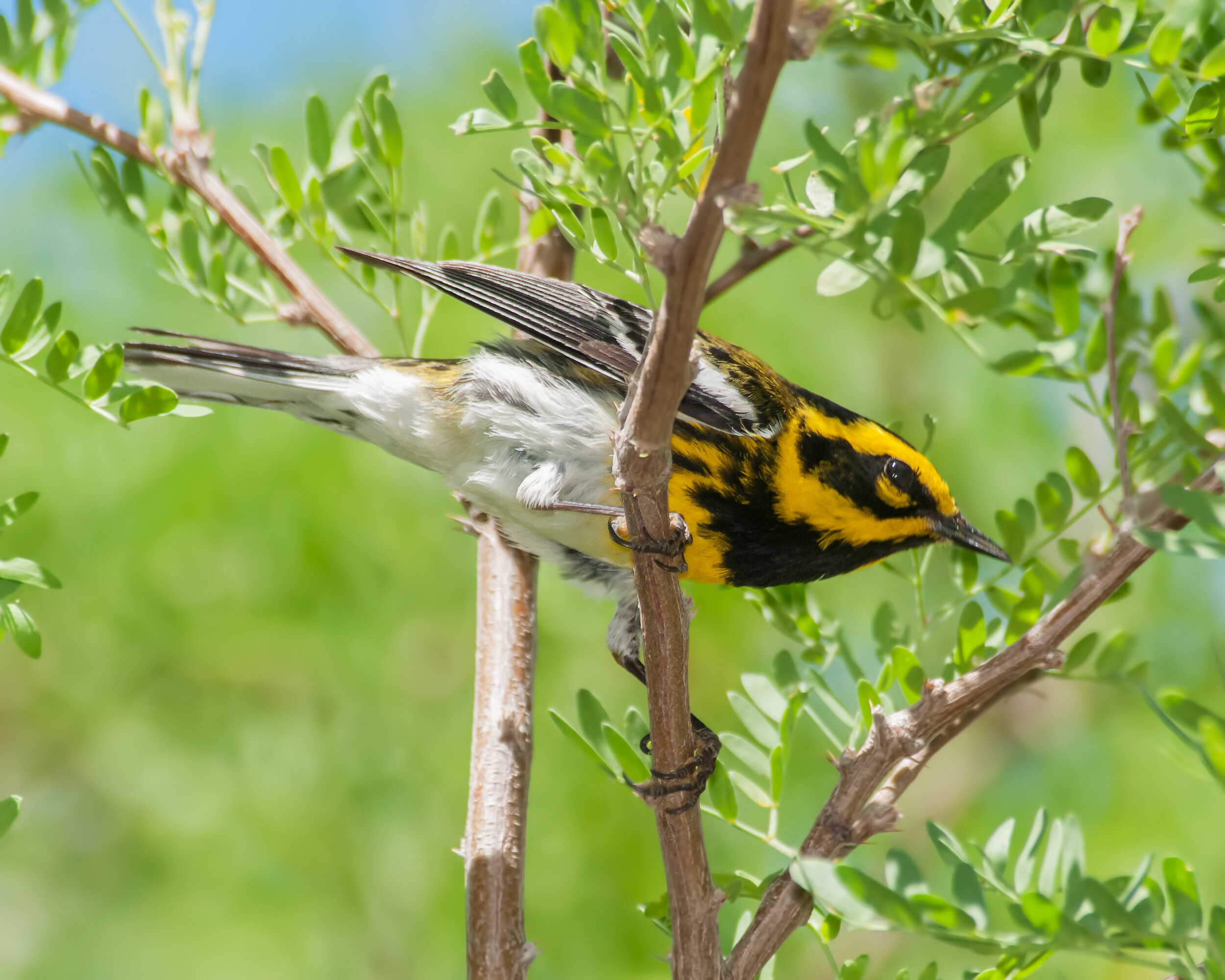
Townsend’s Warbler, Image by Daniel Lee Brown
Lower Sunrise Area
The Lower Sunrise area is on the south side of the American River, and runs from the Sunrise Boulevard bridge downstream to the picnic area of Ambassador Park. Low bluffs overlook the river, their banks covered with blackberry, coyote bush, willow, and poison oak.
Colonies of Acorn Woodpeckers can be seen as well as Nuttall’s Woodpeckers and an occasional Downy Woodpecker. Oak Titmouse, Bushtits nest in the trees. Tree Swallows have been joined by their migrant cousins. Bewick’s Wrens, Spotted Towhees, and California Towhees are year-round residents and are joined by House Wrens in spring. Migrating songbirds such as Townsend’s Warblers, Hermit Warblers, Nashville Warblers, Wilson’s Warblers, Bullock’s Orioles, and Black-headed Grosbeak may be spotted. Look for Black Phoebes and Belted Kingfishers foraging along the river’s edge.
Directions: From downtown Sacramento, take Highway 50 east for 14 miles from Interstate 5, exit at Sunrise Boulevard, and go north for 1.5 miles. Just before the approach to the Sunrise Avenue bridge over the American River, follow the sign indicating river access to the right and continue to the entry station. About 75 feet past the entry station, the road forks. Turn left and follow the road back under the Sunrise bridge and proceed to the parking area. Lower Sunrise can also be entered from Ambassador Park. From Highway 50, take Sunrise Boulevard north for 0.8 mile and turn left on Coloma Road. Travel 0.9 mile to El Manto Drive and turn right. Continue 0.2 mile to Ambassador Drive. Turn right and drive 0.25 mi to the parking lot of Ambassador Park on the left. The entrance fee is currently $7 per vehicle (or a $60 annual pass).
- Excerpted from Lower Sunrise Area by Barbara Mohr
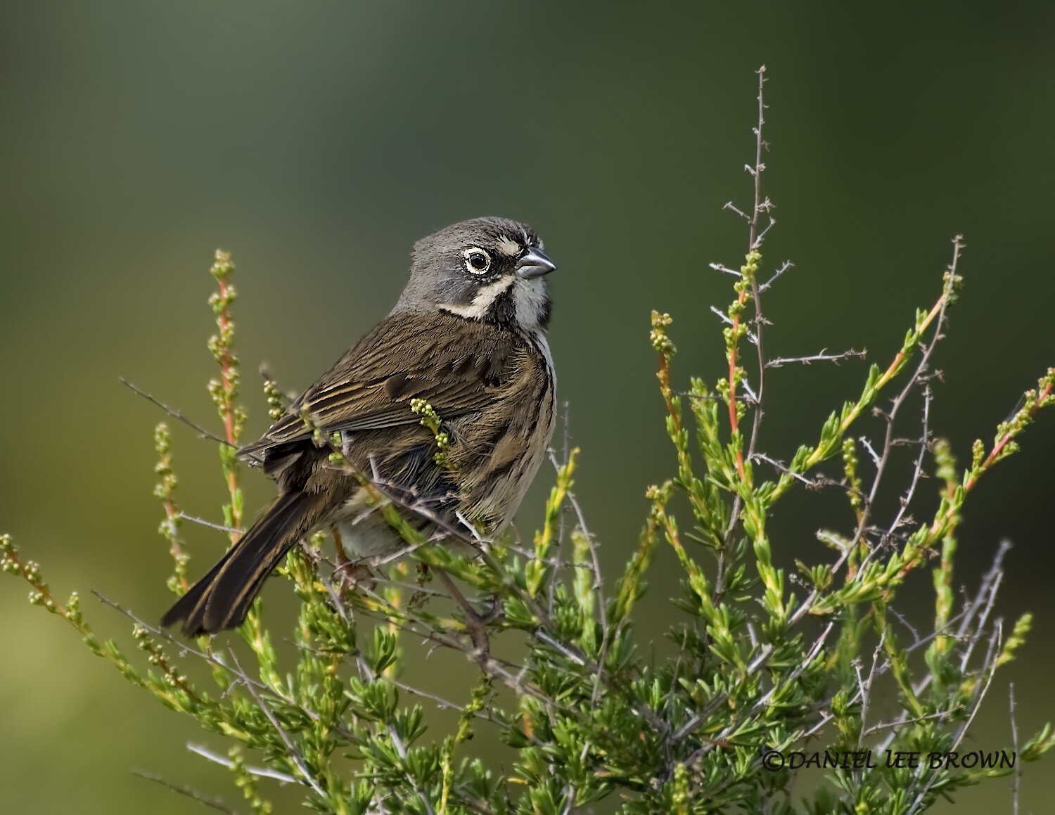
Bell’s Sparrow, Image by Daniel Lee Brown
Sand Creek Road
The area traversed by Sand Creek Road is a classic California landscape in remote Colusa County. You’ll pass through a mix of habitats, including a broad open valley, oak woodlands, and chaparral. After 11 miles, you’ll come to an overlook with a wonderful panorama of the Central Valley, the Sutter Buttes, the Capay Valley, the Coast Range, and, on a clear day, the Sierra Nevada.
This is the best site locally for Greater Roadrunners and among the best for Lawrence’s Goldfinches. California Thrashers and Bell’s Sparrows are commonly heard and often seen in spring, and Black-chinned Sparrows are possible. Mountain Quail call in the spring.
Directions: From Sacramento, take Interstate 5 (47 miles north of Highway 50) to the Arbuckle/College City exit (exit 566). Turn left on Hillgate Road and go 4.8 miles to a 90 degree bend to the right. Go north from the bend for 0.4 mile to Sand Creek Road and turn left (the sign may be missing). Pavement ends after 3.6 miles, and it becomes a good quality gravel road, suitable for a passenger car as far as the Yolo County line (11 miles) unless there have been recent heavy rains.
- Excerpted from Sand Creek Road by Chris Conard