Originally published December 1, 2021
Sandhill Cranes, South of Sacramento off I-5
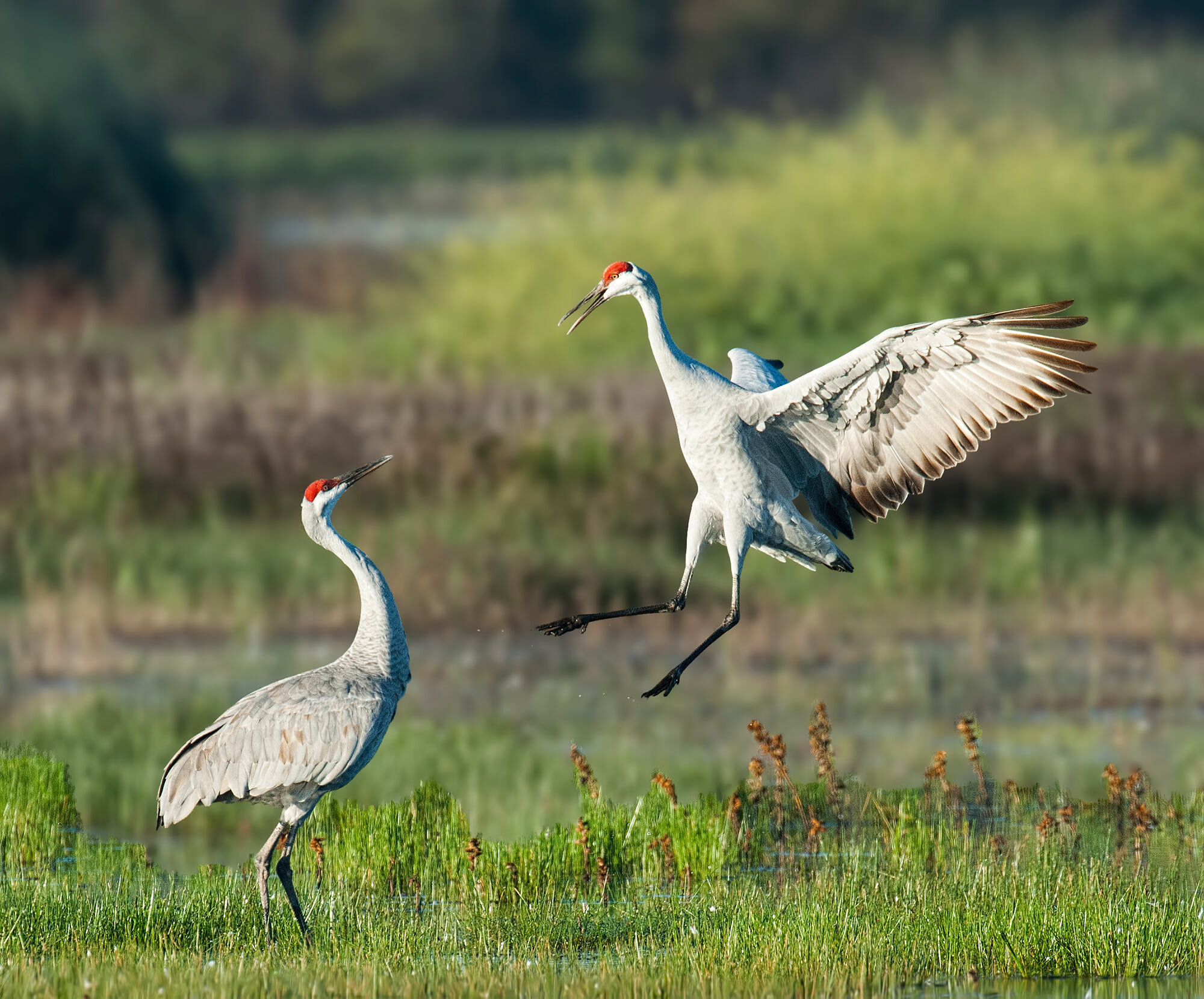
Sandhill Cranes at Cosumnes River Preserve, Image by Ray Rozema
Sandhill Cranes are a specialty of the Central Valley in late fall and winter, and unlike birding for other species, late day-early evening viewing of these amazing birds can be a great success. Several of the best places to do this are south of Sacramento near I-5. First in the string of sites is Cosumnes River Preserve where they can be found along Desmond Road and on both sides of Franklin Boulevard.
My favorite Crane experience can be found at Staten Island late afternoon and just past sunset. This is when large numbers of Sandhill Cranes come in to rest overnight in the safety of shallow, flooded fields. To see these birds against the sky at dusk, especially if there is also a great sunset, is a wonderful treat. Birding is done from the road only as this is a working agricultural area.
The third site heading south on I-5 is Woodbridge Ecological Reserve (aka Isenberg Crane Preserve.) Viewing from a parking lot is excellent any time of the day, and one of the places where the fly-in at dusk can be spectacular.
All three venues also support large numbers of ducks and geese. Shorebirds may be present, raptors work the surrounding fields, and wintering sparrows can be found in the open fields and along hedgerows.
- Maureen Geiger
Directions
Cosumnes River Preserve - drive south on I-5 from Sacramento about 20 miles to Twin Cities Road. Exit and cross over the freeway heading east to Franklin Boulevard. Turn right onto Franklin and go south 1.7 miles; the Visitor Center will be on the left.
Address: 13501 Franklin Blvd, Galt, CA 95632
Staten Island - take I-5 south from Sacramento for 24 miles to the Walnut Grove/Thornton exit, #493. Head west for 3.8 miles on Walnut Grove Road. Shortly after crossing the Mokelumne River, turn left on Staten Island Road. Continue down this road about half a mile to the flooded fields. Stay on the road as this is a working agricultural area.
Google Map Point for Staten Island
Woodbridge Ecological Reserve - from Sacramento take I-5 south to Peltier Road, exit #490. At the bottom of the exit, turn left to Thornton Road where you will go right. Continue on Thornton until the stop sign at the corner of Woodbridge Road. At this point make a right turn only Woodbridge Road which goes west under the I-5 freeway. Drive 2.4 miles to the turnout of the Preserve on the left side of Woodbridge Road.
Google Map Point for Woodbridge Ecological Reserve
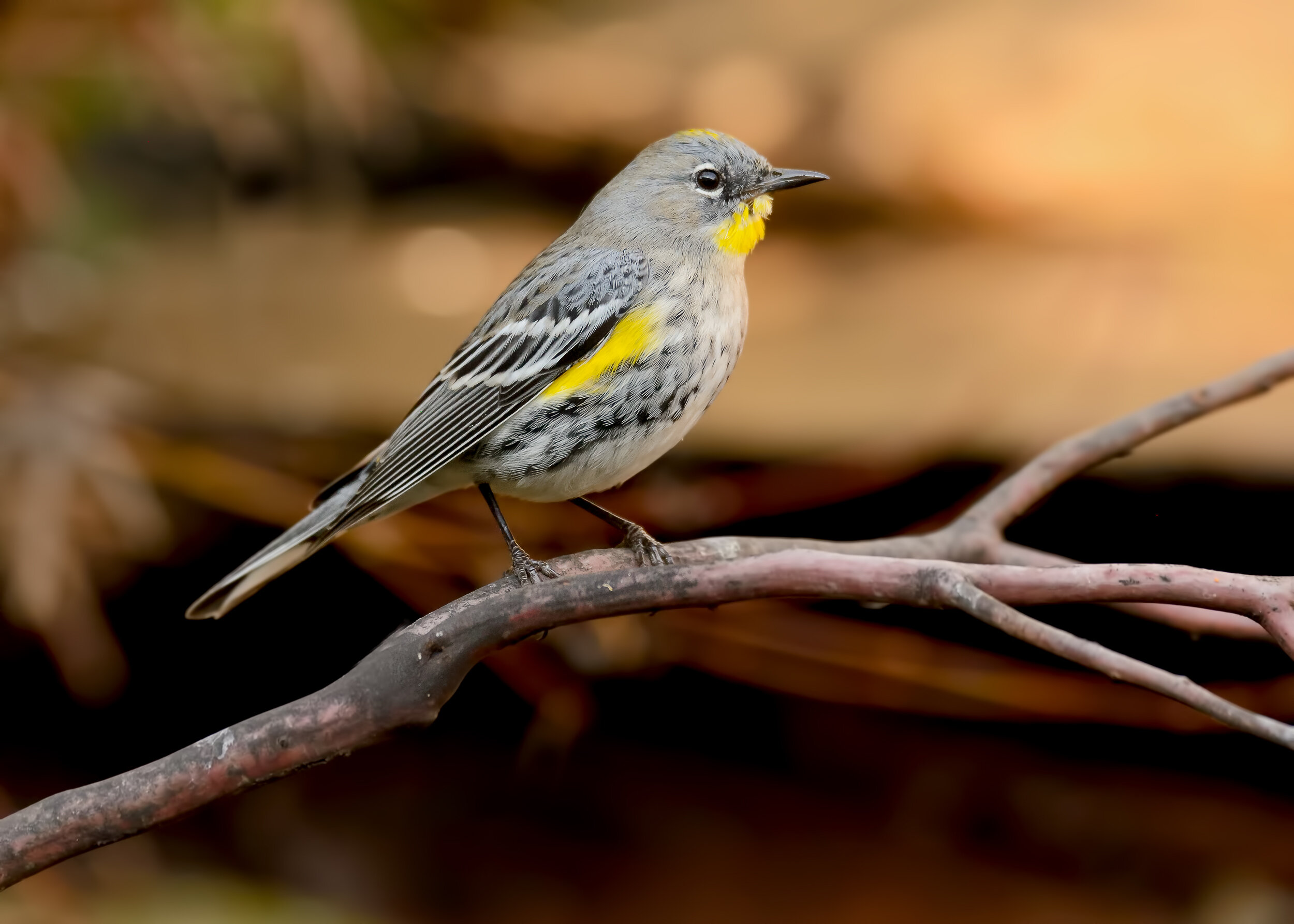
Yellow-rumped Warbler, Image by Daniel Lee Brown
This large, wooded park offers a variety of trails to explore, riverfront, shaded oak woodlands and open grassy areas. Entering the park, follow the road in till it crosses the bike path, then take your first left and continue to the main parking area. The mown picnic area lawn is good for turkeys, Western Bluebirds, Dark-eyed Juncos, Yellow-rumped Warblers, and Red-shouldered Hawks. Then take the river trail going upstream, watching the oak woodland for towhees, wrens, Oak Titmice, and other passerines, and scanning the river for mergansers, goldeneye and Bufflehead. Shortly after you pass another parking lot/bathroom/picnic area, there is a large rocky island midstream, which is good for yellowlegs, Spotted Sandpipers and Killdeer. Herons, egrets, and Belted Kingfishers can be found in this area too. When you reach the triangular 15 mile sign, it's time to turn back. You can return on the same trail, or take the side trails down to the cobbled river bank or into the oak woodland. From the developed section of the park you can cross the river on the footbridge to William Pond Park. The bridge offers good views up and down river; sometimes you can watch mergansers hunting underwater. This park is worth several trips, as the extensive oak woodland between the bike trail and the river is criss-crossed with smaller trails. Great Horned Owls are often found in these woods.
Directions
Address: 2300 Rod Beaudry Dr, Sacramento, CA 95827
From Folsom Blvd., between Bradshaw and Mather Field Road, take Rod Beaudry Drive north into the park. A Sac County Park Pass or $7 entry fee is required for all vehicles.
- Cathie Lazier
East Lawn Cemetery (AKA East Lawn Memorial Park)
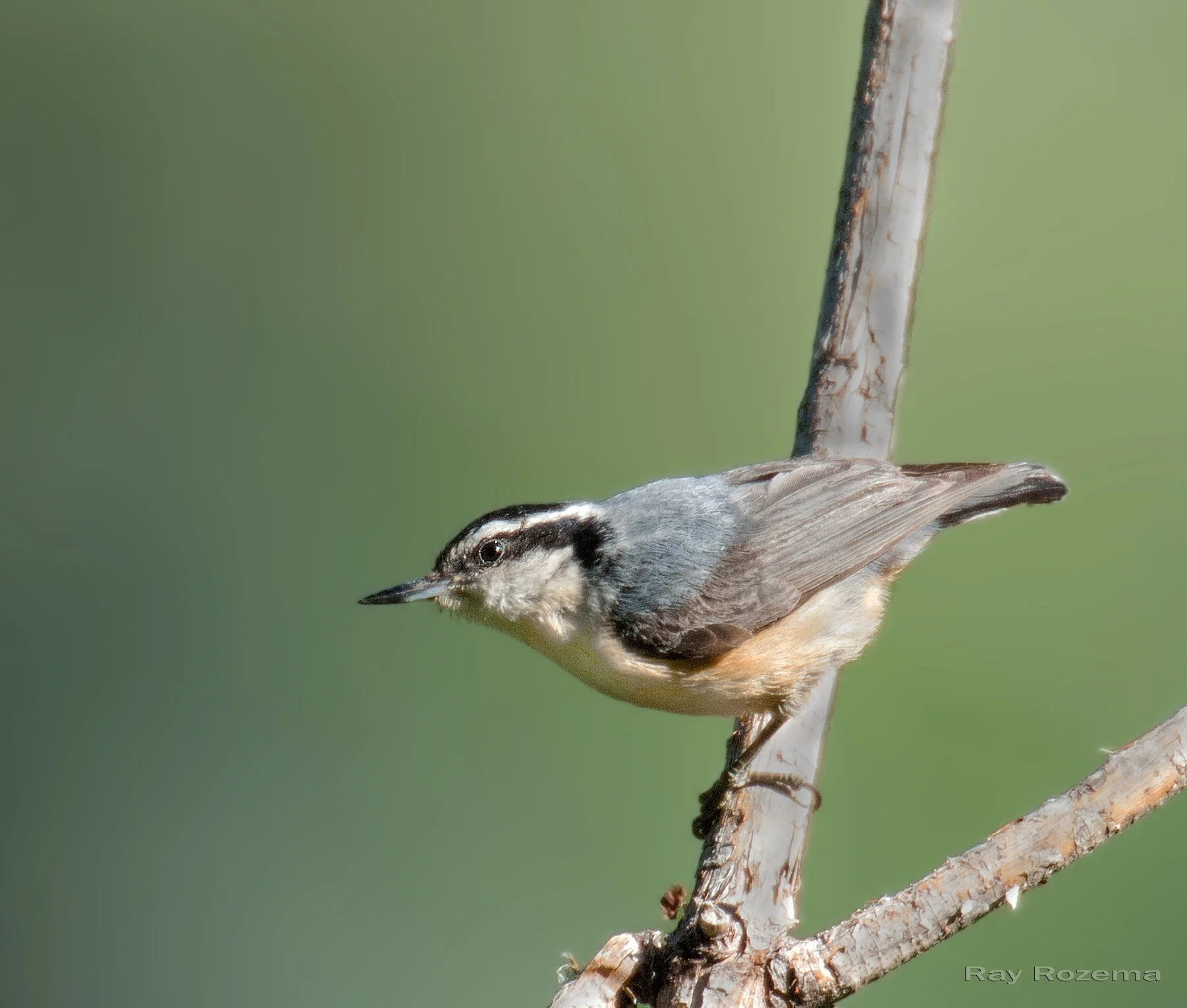
Red-breasted Nuthatch, Image by Ray Rozema
This park-like setting has mowed lawns and tall evergreen and deciduous trees such as palm, oak, maple, pine, and magnolia. Dense shrubbery lines the west boundary with a few thickets scattered throughout the cemetery, and paved roads meander through this 40-acre park. The wonderful old trees are a haven for common wintering birds and may produce less common species such as Red-breasted Nuthatches, Mountain Chickadee, and Red-Breasted Sapsuckers. Winter hours are 8 a.m. to dusk.
Directions
Address: 4300 Folsom Blvd, Sacramento, CA 95819
The entrance is on Folsom Boulevard at 43rd Street. From Sacramento City, take Highway 50 east to 34th Street exit (2.3 miles east of Interstate 5). Turn left at 34th Street and go 0.6 mile to Folsom Boulevard. Turn right and go 0.7 mile to the cemetery entrance. Parking is permitted along the paved roads.
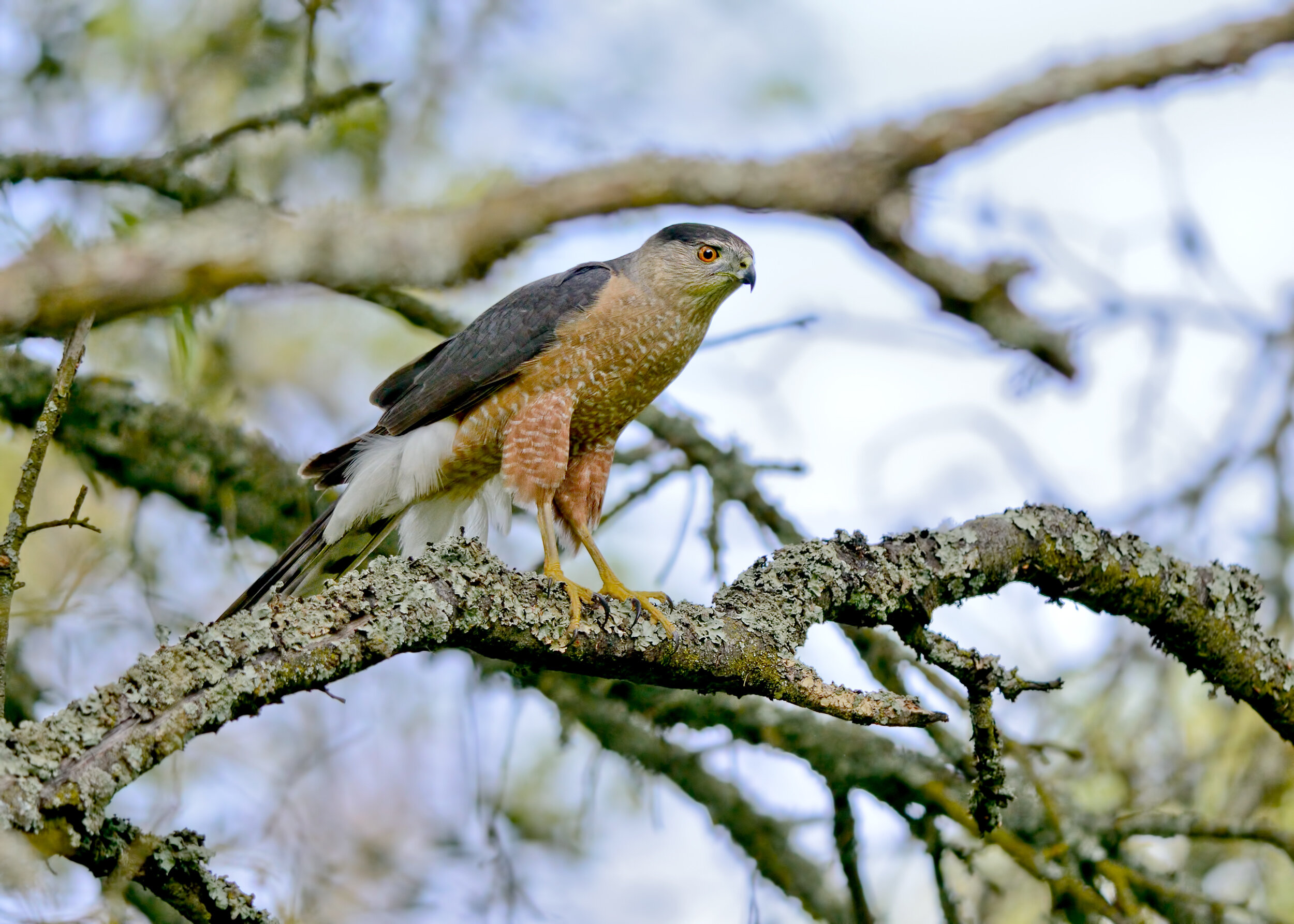
Cooper’s Hawk, Image by Daniel Lee Brown
Bobelaine is home to a wide variety of birds and wildlife throughout the seasons. Winter is a nice time to explore the trails and search for resident and wintering birds such as woodpeckers, Cedar Waxwings, Yellow-rumped Warblers, Ruby-crowned Kinglets, Hermit Thrushes, and Spotted Towhees. A variety of other sparrows, including Fox Sparrows, are settling in for the winter. Woodland raptors such as Red-shouldered Hawk, Cooper’s Hawk, and Sharp-shinned Hawk may be found as well. Trails are accessed via a high, steep levee; but once inside the Preserve, you can walk several miles on mostly level ground.
Directions
Address: 15 Laurel Ave, Yuba City, CA 95991
From Sacramento take Hwy. 99 north toward Yuba City; about 2 miles north of the Feather River Bridge, turn right on Laurel Avenue. Follow Laurel to the dead end at the Bobelaine parking lot.
Colusa National Wildlife Refuge
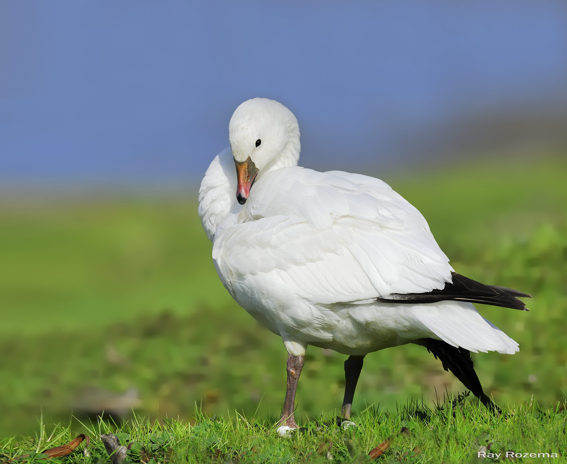
Ross’s Goose, Image by Ray Rozema
Approximately 1 hour north of Sacramento, the Colusa NWR is a great location to view large waterfowl concentrations. There will be plenty of ducks and geese, as well as other wetland species, passerines and raptors. Spend time at the viewing platform where a spotting scope will be useful, and then take an easy walk on a level trail through riparian habitat next to the main viewing pond. Finish your outing to this wonderful NWR by taking the short auto tour. More information about Colusa National Wildlife Refuge can be found at the U.S. Fish and Wildlife Service website.
Directions:
Address: 2180 State Hwy 20, Colusa, CA 95932
From Sacramento head north on I-5. Take exit at Hwy 20 at Williams. Go 6.7 miles east on Hwy 20. Turn right onto O Hair Road and follow the road to Visitor Area.
Fees: Entrance passes are not currently required for admission into the Visitor Use Areas of Colusa NWR.
Recommendations provided by Sacramento Audubon Field Trip Leaders: Maureen Geiger and Cathie Lazier.